Climate-driven upward spread of forest disturbances in mountain regions
O 2.2 in Mountains and Vegetation Dynamics
30.04.2026, 11:15-11:30, FZA conference room
Forest disturbances are intensifying under climate change, reshaping the structure and functioning of mountain ecosystems. However, understanding how these disturbances vary across environmental gradients requires spatially continuous monitoring across large areas. Recent advances in remote sensing and artificial intelligence now enable the systematic observation of forest disturbances across broad spatial gradients.
Here we combine remote sensing data, statistical modelling, and deep learning approaches to investigate emerging disturbance patterns, including tree mortality and forest fires in European mountain forests. Analyses of wildfire activity across European mountain regions reveal a marked upslope expansion of forest fires since 2015, with climatic dryness emerging as the dominant driver of burned area, particularly above ~1,400 m elevation. At a finer spatial scale, nationwide deadwood mapping from high-resolution aerial imagery shows that standing deadwood in Switzerland is concentrated at mid to high elevations (~1,550 m), where mortality hotspots emerged following recent drought and heat extremes, particularly in conifer-dominated forests.
Together, these examples illustrate how multiple disturbance processes are reorganizing along environmental gradients in mountain landscapes. Emerging AI-based monitoring approaches combining satellite and aerial imagery provide new opportunities to detect disturbance hotspots, quantify forest vulnerability, and support climate-adaptive forest management.
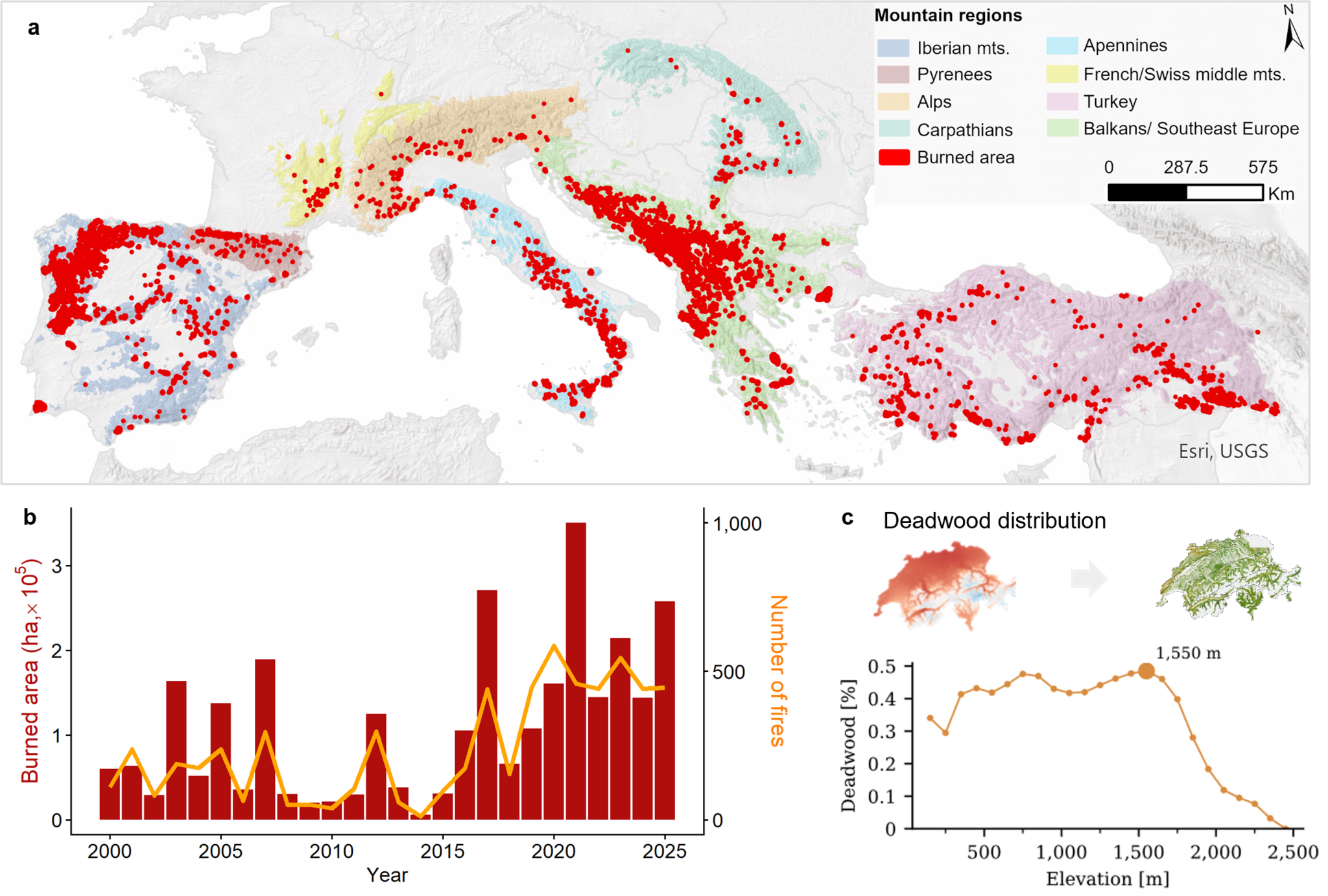
Spatial patterns of forest fires and deadwood. a Locations of forest fires ≥30 ha across eight major mountain systems in southern and central Europe (2000–2025). b Annual burned area and number of fires. c Elevational distribution of deadwood across Switzerland.
Export as iCal: