


Institute
of
African Studies
Consortium for Research in East African Tropical Ecosystems
Social-Ecological-Systems of Western Kenya
![]()
The natural ecosystems of Kenya have been influenced by man for millennia. Nevertheless, early land use systems were still loosely in equilibrium with nature and sustainable with relatively low human population.
Only in the last 100 years and especially in the post-colonial era has land use become almost totally modified as illustrated above. Aside from the national parks and reserves (upper left), landscapes are now dominated by a finely fragmented mosaic of small farms. Life in small farms associated with thousands of scattered villages has changed the biogeochemical cycles and potentials for utilizing natural resources. As described elsewhere in these pages, important management considerations focus on the restoration of both forests, and life styles in the direction that native crops rather than monoculture crops are utilized.
CREATE is particularly interested in comparing and contrasting biogeochemical cycles and the harvesting of ecosystem services in the natural versus anthropogenically dominated land use systems of Kenya. As in other regions of the world, it is recognized that Social-Ecological-Systems must be studied in order that resource management can best serve the interests of the Kenyan people.
Nzoia River Basin
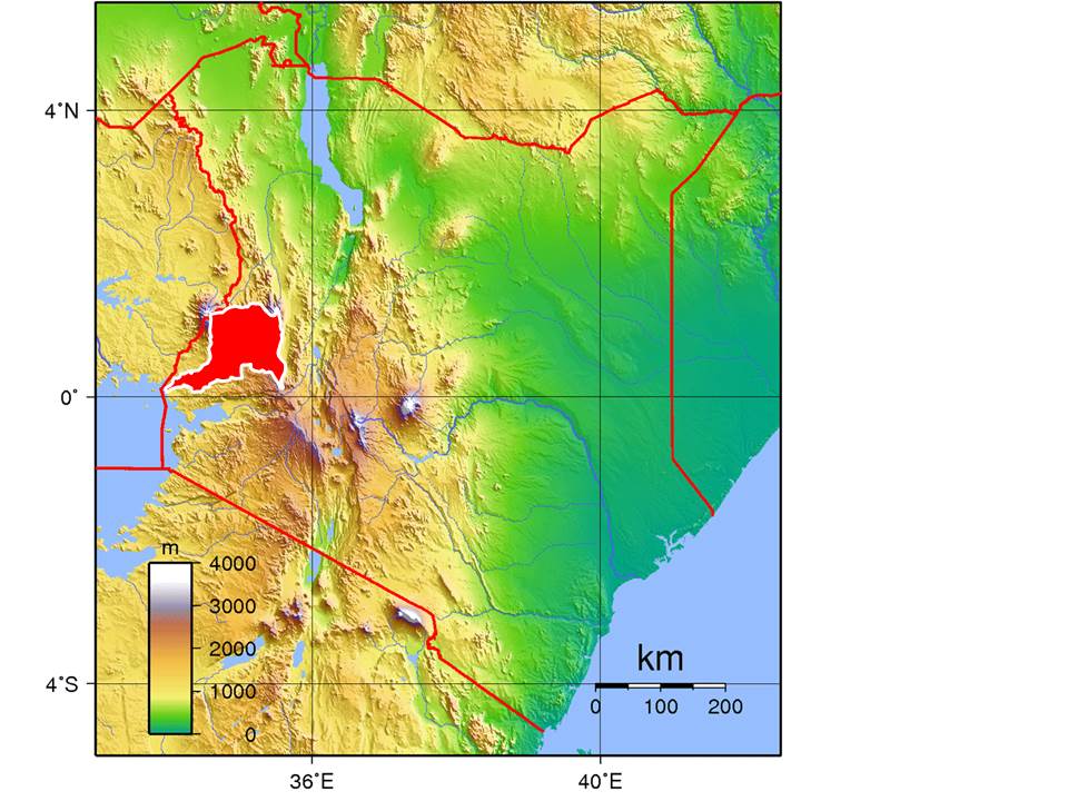
Red area: Nzoia River Basin in West Kenya at Lake Victoria
The Nzoia River Basin north of Maseno encompasses many of the social-ecological-system components characteristic for land use in Kenya. The basin includes Mt. Elgon National Park, e.g., the entire spectrum of natural ecosystems along the altitudinal gradient found in the western region. It also includes large parts of the Kakamega Forest. It is representative for land use and stepwise changes that have occurred from highland forested areas down to the outlet into Lake Victoria.
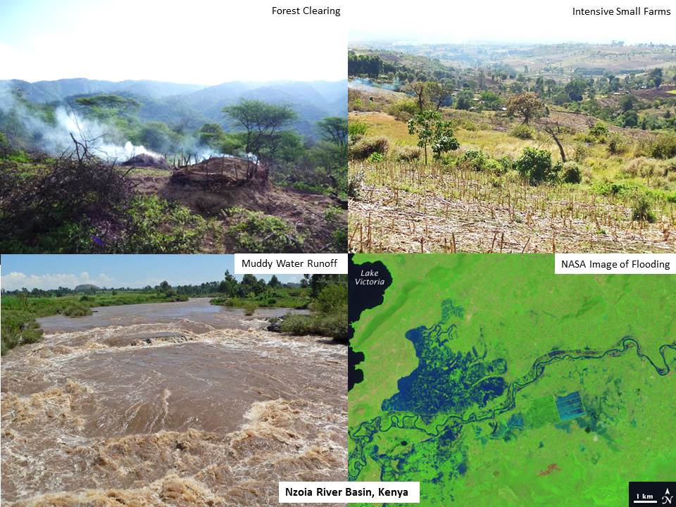
Deforestation and Flooding
Deforestation in the Cheranganyi Hills at the eastern extent of the Nzoia River Basin together with intensive farming of slopes has led to high run-off and erosion of soils. Although agriculture is periodically limited due to aridity, run-off during the rainy season leads to large flood events at downstream locations.
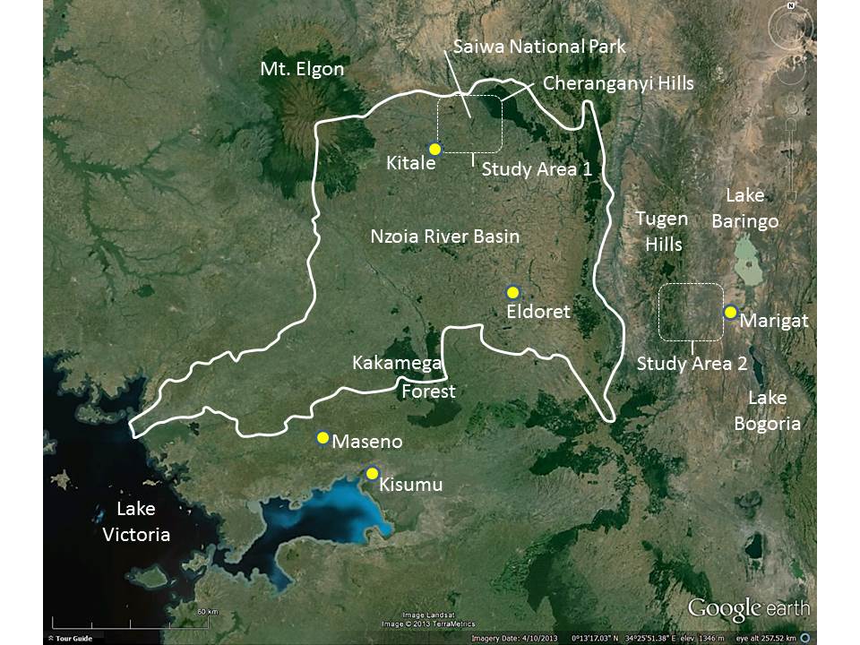
Study areas for deforestation effects
Deforestation in the Cheranganyi Hills and Tugen Hills has altered water balances and resulted in increased soil erosion and sediment transport in the first case in the Nzoia River, and in the second case to Lakes Baringo and Bogoria. Potentially, these changes in turn will lead to large multiple reductions in ecosystem services. Additionally, local deforestation on lower elevation slopes together with added water extraction by local populations influence the water balance of critical wetlands (for example, Saiwa National Park and other conservation areas).
The research in this study focuses on the areas shown in the figure above. The goals are to:
-
understand policies and factors that lead alternatively to deforestation or reforestation
-
consider the economics associated with deforestation versus reforestation, and
-
consider potentials for use of tree crops (avocado, mango, papaya) or adapted native species (Aloe vera) to alleviate problems tied to deforestation


![]()