

BayCEER Workshop 2016
October 13, 2016
NW III, University of Bayreuth
From toys to tools: assessing vegetation structural parameters and potential disturbance impacts using an Unmanned Aerial Vehicle (UAV)
2 Dept. of Geosciences, University of Bayreuth
O 6.3 in Paving the way for research: Databases, instruments, networks & Open Session
13.10.2016, 16:30-16:45, H36, NW III
Introduction
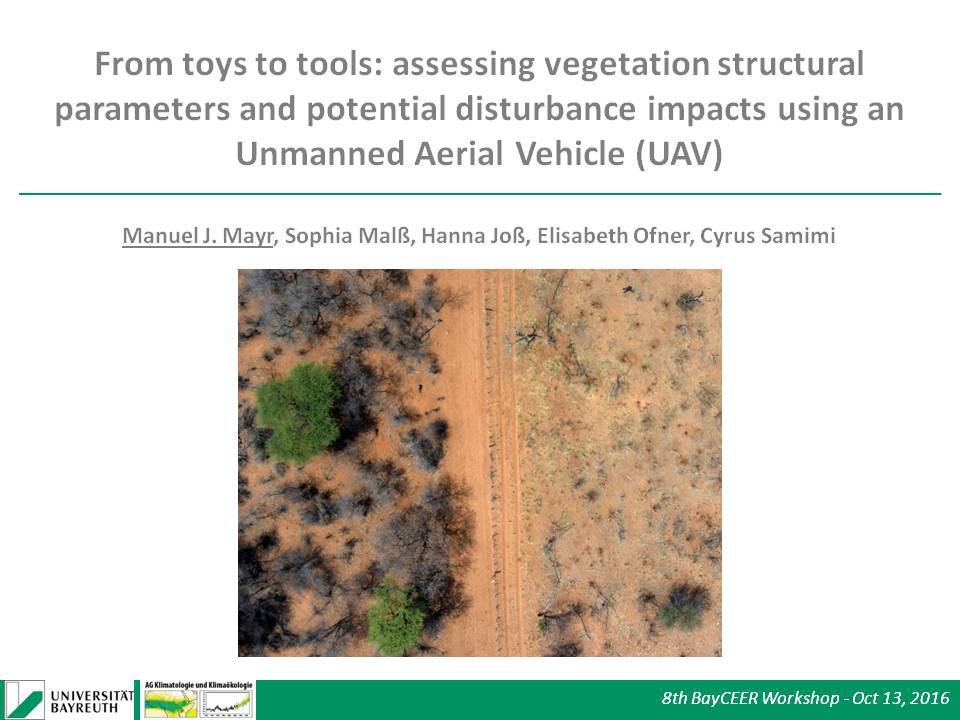
Recent advances in microelectronics and computer vision have enabled Unmanned Aerial Vehicles (UAV) equipped with consumer-grade cameras to become serious remote-sensing systems. Whereas major advantages of such systems clearly come from the flexibility in data acquisition, spatial resolution and comparably low cost, data processing workflows and applications are still experimental. Here we use an UAV to assess vegetation structural parameters (height and cover) in a savanna environment in Namibia.
Material and Methods
The flights were carried out on 19 plots (0.65 - 1.85ha). We used a Structure from Motion (SfM) approach to generate mosaicked orthophotos, Digital Surface Models (DSM) as well as Digital Elevation Models (DEM) derived from point cloud classification. Canopy Height Models (CHM), from DSMs and DEMs, were further processed using watershed segmentation to yield per-plot heights. To assess woody covers, we applied a fuzzy logic rule-based feature extraction approach.
Results
UAV-derived height parameters (maximum, mean, median) showed good agreement with in situ measured heights (R² ~ 0.7) and could thus be used as a surrogate for those in assessing the influence of disturbances on per-plot heights. In contrast, woody covers were severely underestimated in the UAV-derived approach. Per-plot maximum heights were significantly lower on plots that were burned within the last 15 years and decreased as a function of an intensified disturbance regime. Frequently grazed plots had significantly lower mean heights.
Conclusion
The study presented here demonstrates the potential of UAV remote sensing for ecological applications. In terms of accuracy, the results for the derived heights are promising. The retrieved disturbance-vegetation relationships are clearly a simplification of the real world (assumed quasi-homogeneity of the plots). Future work will have to include further determinants of vegetation structure (e.g. soil, species differences, meteorological disturbances).
First slide O 6.3
Keywords: Unmanned Aerial Vehicles, remote sensing, Structure from Motion, feature extraction, savanna, disturbance impacts, fire
Export as iCal: