Bayesian statistical approaches for parameterization of landscape agricultural production models
TERRECO WP 3-02
Von 04/2009 bis 12/2015
Projektleiter: John Tenhunen, Thomas Koellner, Björn Reineking Mitarbeiter: Bumsuk Seo Bewilligung: IRTG 1565 WP III TERRECO - Complex Terrain and Ecological Heterogeneity - Evaluating ecosystem services in production versus water yield and water quality in mountainous landscapes
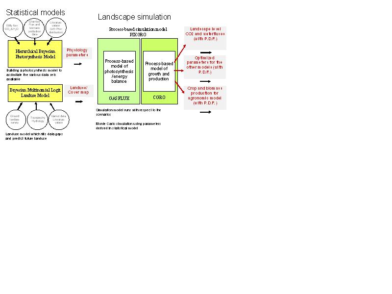
Since agricultural practices significantly affect ecosystem dynamics, landscape material balances and economically important outputs, there is a great need in global change studies for reliable and up-to-date information on agricultural land use and land cover. Although it requires only observation, such data are often scarce or even impossible to obtain. This is the case in our 2800 km2 study area in the SoyangLake watershed, South Korea. In this context, we have designed a LULC model to describe agricultural crop distribution, based on field mapping in a restricted area (Haean Catchment – 25 km2 cropped area). The specific goals of our model are (1) to fill data gaps that remain in directly studied landscapes and (2) to implement the model over a larger region by utilizing remotely sensed data. Detailed information was surveyed for all crop fields in the Haean Catchment which provided coverage over 91% of the fields. Subsequently, we constructed a multinomial probit model at the catchment level and missing data were interpolated. Both traditional and Bayesian approaches were tried and the performances were compared. The Bayesian model provided more explanative power. At the watershed level, ground-based crop observational data is not feasible. Therefore, the remote sensing must be used to complement ground data.